Height of Mount Toubkal: Africa's Highest Peak and What to Expect
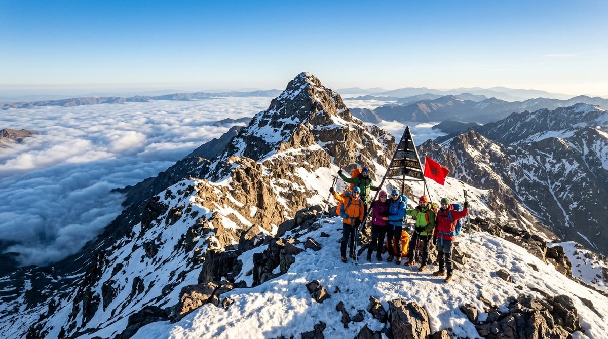
Rising above the rugged ridges of the High Atlas mountains, Jbel Toubkal stands tall as the roof of North Africa. At an official height of 4,167 metres (13,671 feet), this dramatic mountain draws hikers, mountaineers, and travelers from around the world. On a clear morning from its jagged crest, your eyes can sweep across the plains toward Marrakech to the north and gaze southward into the vast, silent stretches of the Sahara desert.
For Moroccans and visitors alike, climbing Toubkal is far more than an athletic trek. It is a passage through ancient Amazigh (Berber) territory, where terraced walnut groves hug rushing riverbeds and stone villages cling to sheer hillsides. The journey combines physical grit with mountain hospitality, steaming mint tea, and hearty communal meals that restore weary legs at the end of each trail day.
Here is a practical guide to the height of Mount Toubkal, what the climb entails, what you will eat along the trail, and how to prepare for this memorable Moroccan adventure.
Understanding the Height and Geography of Toubkal
Mount Toubkal (often written Jbel Toubkal in Arabic and Darija) sits within Toubkal National Park, approximately 63 kilometres south of Marrakech. Its elevation makes it not only Morocco’s highest peak, but the tallest point in the entire Atlas mountain system and all of the Arab world.
To put its 4,167-metre height into perspective:
- Mount Toubkal is higher than Japan’s Mount Fuji (3,776 m).
- It is higher than Spain’s highest peak, Mount Teide (3,718 m).
- It is only slightly lower than the Matterhorn in the European Alps (4,478 m).
Despite this commanding altitude, Toubkal is renowned as one of the most accessible 4,000-metre peaks on the planet. Unlike technical summits requiring ropes, crampons on sheer ice walls, or complex rock climbing maneuvers, the summer route up Toubkal is essentially a strenuous non-technical mountain trek. However, its altitude must never be underestimated. The air at 4,000 metres holds significantly less effective oxygen than at sea level, and proper pacing is the secret to reaching the summit with a smile.
The Journey Begins: Imlil Valley Base Camp
Almost every trek up Toubkal begins in Imlil, a charming mountain settlement tucked into the Mizane Valley at an elevation of roughly 1,740 metres. Shaded by dense groves of walnut and apple trees, Imlil serves as the active logistical hub for the High Atlas.
Here, travelers meet their licensed mountain guides, pack mules, and muleteers (muletiers). Under Moroccan regulations enacted for safety, all foreign hikers attempting Toubkal must be accompanied by an accredited local guide and check through official police checkpoints along the trail. This rule not only protects visitors but supports the livelihood of local Amazigh families whose knowledge of these treacherous stone passes spans generations.
Before setting off from Imlil, hikers typically gather in a village gîte (stone guesthouse) for a traditional breakfast: hot crusty khobz (Moroccan round flatbread), golden olive oil, wild thyme honey, and amlou—the rich Atlas paste made by pounding roasted almonds, argan oil, and honey with a heavy stone mortar. Paired with sweet mint tea (atay), this meal delivers sustained energy for the steep climb ahead.
The Standard Two-Day Trek: Step by Step
While some prefer a leisurely three or four-day circuit exploring neighboring Berber valleys like Azzaden, the classic Toubkal ascent is tackled over two focused days.
Day 1: From Imlil to the Mountain Refuges
- Distance: Approximately 11 kilometres
- Elevation Gain: From 1,740 m to 3,207 m (gain of ~1,467 metres)
- Trekking Time: 5 to 6 hours
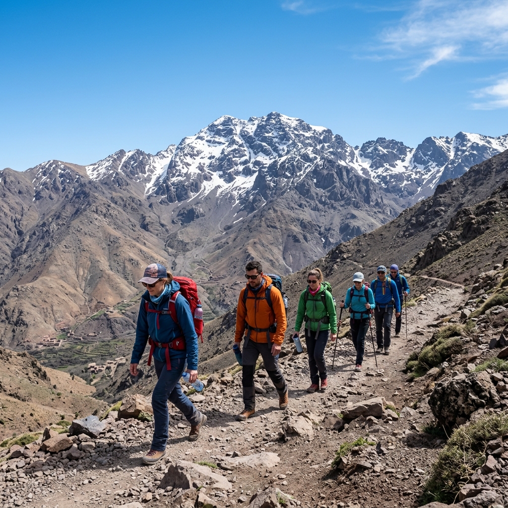
The trail winds gently out of Imlil, passing the picturesque village of Aroumd built upon an ancient glacial moraine. You follow the rocky bed of the Mizane River, gradually gaining altitude as the green trees give way to sparse alpine scrub.
Around halfway, you reach the sacred shrine of Sidi Chamharouch, perched at 2,310 metres. Legend says a pre-Islamic king of the jinns is buried beneath a large whitewashed rock here. Travelers stop beside the roaring stream at modest wooden shacks serving fresh-squeezed orange juice, walnuts, and steaming pots of sweet tea.
From Sidi Chamharouch, the trail steepens considerably, zig-zagging up scree slopes toward the head of the valley. By late afternoon, you arrive at the twin high-altitude refuges: the Refuge du Toubkal (operated by the French Alpine Club) and the privately owned Les Mouflons refuge, both sitting at 3,207 metres.
Here, you warm your hands by the wood stove, swap stories with hikers from five continents, and sit down to a generous mountain tagine of tender beef, root vegetables, chickpeas, and warm bread. Sleep comes early in shared dormitory bunks, as summit day begins long before dawn.
Day 2: Summit Push and Descent to Imlil
- Distance: Approximately 4 kilometres to summit, then 15 kilometres down
- Elevation Gain/Loss: +960 m to summit (4,167 m), then -2,427 m back to Imlil
- Trekking Time: 9 to 11 hours total
Wake-up call sounds at 4:30 AM in the cold alpine dark. After a quick breakfast of porridge, bread, cheese, and sweet coffee, you strap on your headlamp and begin the ascent.
The path climbs straight up the South Cirque (Ikhibi Sud), navigating steep scree fields and loose shale. In winter and early spring (November to May), this section is locked in hard snow and ice, requiring crampons and ice axes. In summer, it is a steady slog against gravity.
Pacing yourself is critical. Experienced Amazigh guides whisper “chwaya b chwaya”—slowly, slowly in Moroccan Darija. Taking deliberate, steady steps prevents altitude headaches and conserves oxygen.
As the eastern horizon turns amber and rose, you reach the Tizi n’Toubkal ridge at 3,975 metres. The final ridge walk brings you to the summit plateau, marked by a famous pyramidal metal tripod erected in the 1930s. Standing at 4,167 metres, the view is awe-inspiring: rolling mountain chains unfold in every direction like waves of stone, completely silent beneath the vast African sky.
After celebrating, taking photographs, and catching your breath, the descent begins. Returning to the refuges takes about two hours, where a warm lunch awaits, followed by the remaining four-hour hike down the valley back to Imlil.
Mountain Sustenance: What You Eat on Toubkal
Food on an Atlas trek is not freeze-dried packets; it is fresh, comforting, and deeply rooted in Moroccan culinary traditions. Amazigh muleteers and trail cooks produce astonishingly flavorful meals using simple gas burners.
Common mountain trail foods include:
- Berber Omelette: Eggs gently poached in an earthenware dish over a bubbling reduction of grated tomatoes, garlic, cumin, sweet paprika, and olive oil, scooped up with thick chunks of bread.
- Lentil and White Bean Stews (Loubia and Addas): Hearty legumes simmered with onions, turmeric, ginger, and coriander, providing plant-based protein and warmth.
- Steamed Vegetable Couscous: Piled high with sweet carrots, pumpkin, zucchini, and cabbage, drenched in rich broth.
- Dried Fruits and Nuts: Walnuts harvested in Imlil, sweet dried figs from the valley orchards, and soft dates carried in coat pockets for steady trail fuel.
- Sweet Mint Tea: Consumed multiple times every single day. The combination of caffeine, sugar, and soothing herbs combats fatigue and soothes digestion at high altitudes.
Best Time of Year to Climb
Choosing when to climb Toubkal depends entirely on your experience and what kind of adventure you seek:
- Late Spring to Early Autumn (May to October): This is the ideal window for standard hikers. The trails are free of snow, days are warm and sunny, and wildflowers carpet the lower valleys. Summer daytime temperatures in Imlil reach 30°C, though the summit remains crisp and cool (often between 5°C and 12°C).
- Winter (November to April): Toubkal transforms into a genuine mountaineering expedition. Snow covers the upper peaks, temperatures plunge well below freezing at night, and crampons, ice axes, and winter gear are strictly mandatory. It is magnificent, but requires mountaineering experience.
Essential Packing List for the Ascent
To ensure a safe and comfortable climb to 4,167 metres, pack thoughtfully:
- Sturdy Hiking Boots: Broken-in boots with reliable ankle support and grippy soles are essential for navigating loose scree.
- Trekking Poles: Indispensable for saving knees and maintaining balance on steep descents.
- Layered Clothing: Thermal base layer, fleece mid-layer, and a windproof, waterproof outer shell. Temperatures at 4,000 metres can feel freezing even in July when winds pick up.
- Sun Protection: High-SPF sunscreen, polarized sunglasses, and a wide-brim hat. UV radiation is intense at high altitudes.
- Hydration System: At least 2 to 3 litres of water capacity, plus water purification tablets.
- Altitude Awareness: Ascend steadily, drink plenty of fluids, and alert your guide immediately if you experience dizziness, nausea, or a pounding headache.
Climbing Mount Toubkal rewards you with breathtaking views, a true sense of personal achievement, and warm memories of Moroccan mountain kindness that stay with you long after you return home.
Frequently Asked Questions
How high is Mount Toubkal exactly?
Mount Toubkal stands at an official elevation of 4,167 metres (13,671 feet) above sea level. It is the highest peak in Morocco, the highest in the Atlas mountain range, and the highest point in all of North Africa.
Can a beginner hike Mount Toubkal?
Yes, reasonably fit beginners can hike Mount Toubkal during the snow-free summer months (June to September). The trek requires no technical climbing skills or ropes. However, it demands strong cardiovascular endurance, leg strength, and proper acclimatization to handle the high altitude and long walking days.
What is the best time to climb Mount Toubkal?
The best months for trekking Toubkal are from May through October, when weather conditions are generally clear and the trails are free of snow. For winter mountaineering with crampons and ice axes, the prime season runs from January to March.
Do I need a guide to hike Mount Toubkal?
Yes. Under Moroccan safety regulations, hiring a licensed local mountain guide is mandatory for foreign visitors climbing Mount Toubkal. Guides register your passport details at official police checkpoints along the trail and provide invaluable route navigation, local insight, and emergency assistance.
Experience the true heart of Moroccan heritage through its culinary traditions. Join us in preserving and honoring these ancestral recipes.
What People Are Saying
No comments yet. Be the first — we'd love to hear from you.
The Moroccan Food
Culturally Verified & Fact-CheckedThe Moroccan Food editorial team brings together native culinary researchers, heritage preservationists, and experienced home cooks across Marrakech, Fes, and Casablanca. Every recipe and cultural guide is reviewed against ancestral oral traditions and authentic regional practices.